
File:Národní park Podyjí Dyje Nationalpark Thayatal 2013 10 a.jpg

Size of this preview: 799 × 599 pixels. Other resolutions: 320 × 240 pixels | 640 × 480 pixels | 1,024 × 768 pixels | 1,280 × 960 pixels | 2,560 × 1,921 pixels | 4,349 × 3,263 pixels.
Original file (4,349 × 3,263 pixels, file size: 6.67 MB, MIME type: image/jpeg)
Summary
| Description |
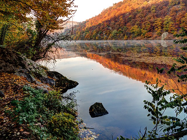
Deutsch: Rabensteintal. Thaya im Podyjí National Park, einem Nationalpark in Tschechien am linken Thayaufer zwischen Znaim und Frain, der an den Nationalpark Thayatal grenzt in / Tschechien / Europäische Union. Stimmung am frühen Morgen. Ein leichter Nebel über der glatten Wasseroberfläche. Die Buchen sind im Oktober rot gefärbt und spiegeln sich im Wasser. English: ThePodyjí National Park, a national park in the South Moravian Region of the Czech Republic / EU. Mood in the morning. A light mist over the smooth water surface. The European beech are colored red in October and reflected in the water. |
| Date | |
| Source | Own work |
| Author | Joadl |
| Permission (Reusing this file) |
Deutsch: Ergänzung zur Lizenz Cc-by-sa-3.0-at. Kostenlose / unentgeltliche / gratis Verwendung, privat oder gewerblich, zu den unten genannten Bedingungen:
English: Supplement to the license Cc-by-sa-3.0-at. Usage is free of charge for private or commercial use under the conditions specified below:
|
| Object location | | View this and other nearby images on: OpenStreetMap |
|---|
Licensing
I, the copyright holder of this work, hereby publish it under the following license:
This file is licensed under the Creative Commons Attribution-Share Alike 3.0 Austria license.
- You are free:
- to share – to copy, distribute and transmit the work
- to remix – to adapt the work
- Under the following conditions:
- attribution – You must give appropriate credit, provide a link to the license, and indicate if changes were made. You may do so in any reasonable manner, but not in any way that suggests the licensor endorses you or your use.
- share alike – If you remix, transform, or build upon the material, you must distribute your contributions under the same or compatible license as the original.

| This is a retouched picture, which means that it has been digitally altered from its original version. Modifications: HDRI/Tone mapping with Photomatix Pro 4.2 of 3 RAW.
|
File history
Click on a date/time to view the file as it appeared at that time.
| Date/Time | Thumbnail | Dimensions | User | Comment | |
|---|---|---|---|---|---|
| current | 19:21, 26 October 2013 | | 4,349 × 3,263 (6.67 MB) | Joadl | == {{int:filedesc}} == {{Information |Description= {{Multilingual description |cs= Národní park Podyjí je dosud jediným moravským národním parkem. Sealsfielduv Kamen. |de= Tha... |
File usage
The following page uses this file:
Global file usage
The following other wikis use this file:
- Usage on af.wikipedia.org
- Usage on az.wikipedia.org
- Usage on be-tarask.wikipedia.org
- Usage on bg.wikipedia.org
- Usage on ca.wikipedia.org
- Usage on ceb.wikipedia.org
- Usage on cs.wikipedia.org
- Usage on da.wikipedia.org
- Usage on de.wikipedia.org
- Usage on en.wikipedia.org
- Usage on eo.wikipedia.org
- Usage on es.wikipedia.org
- Usage on et.wikipedia.org
- Usage on fr.wikipedia.org
- Usage on hu.wikipedia.org
- Usage on it.wikipedia.org
- Usage on ja.wikipedia.org
- Usage on kk.wikipedia.org
- Usage on lld.wikipedia.org
- Usage on lt.wikipedia.org
- Usage on mk.wikipedia.org
- Usage on nl.wikipedia.org
- Usage on nn.wikipedia.org
- Usage on no.wikipedia.org
- Usage on pl.wikipedia.org
- Usage on pt.wikipedia.org
- Usage on ru.wikipedia.org
- Usage on sh.wikipedia.org
- Usage on sl.wikipedia.org
- Usage on sq.wikipedia.org
- Usage on sr.wikipedia.org
- Usage on sv.wikipedia.org
- Usage on www.wikidata.org
- Usage on zh.wikipedia.org