
File:NPS sequoia-kings-canyon-printable-road-map.jpg

Size of this preview: 488 × 599 pixels. Other resolutions: 195 × 240 pixels | 391 × 480 pixels | 625 × 768 pixels | 1,090 × 1,339 pixels.
Original file (1,090 × 1,339 pixels, file size: 239 KB, MIME type: image/jpeg)
Summary
| Description |
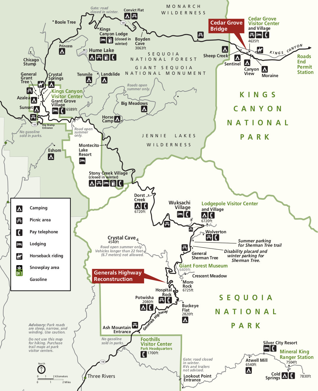
English: This is another road map of Sequoia and Kings Canyon. This map is more suitable for printing than the above full-park maps since it does not have terrain shading and works well in grayscale ink. |
| Date | |
| Source | U.S. National Park Service (http://npmaps.com/wp-content/uploads/sequoia-kings-canyon-printable-road-map.jpg) |
| Author | U.S. National Park Service, restoration/cleanup by Matt Holly |
Licensing
| This image or media file contains material based on a work of a National Park Service employee, created as part of that person's official duties. As a work of the U.S. federal government, such work is in the public domain in the United States. See the NPS website and NPS copyright policy for more information. |
File history
Click on a date/time to view the file as it appeared at that time.
| Date/Time | Thumbnail | Dimensions | User | Comment | |
|---|---|---|---|---|---|
| current | 00:35, 17 May 2017 | | 1,090 × 1,339 (239 KB) | RKBot | =={{int:filedesc}}== {{Information |description= {{en|1=This is another road map of Sequoia and Kings Canyon. This map is more suitable for printing than the above full-park maps since it does not have terrain shading and works well in grayscale ink.}}... |
File usage
The following page uses this file: