
File:4 - 7 Logan Circle.JPG

Size of this preview: 800 × 524 pixels. Other resolutions: 320 × 209 pixels | 640 × 419 pixels | 1,024 × 670 pixels | 1,280 × 838 pixels | 3,126 × 2,046 pixels.
Original file (3,126 × 2,046 pixels, file size: 3.68 MB, MIME type: image/jpeg)
|
This is an image of a place or building that is listed on the National Register of Historic Places in the United States of America. Its reference number is 72001426. |
| Description |
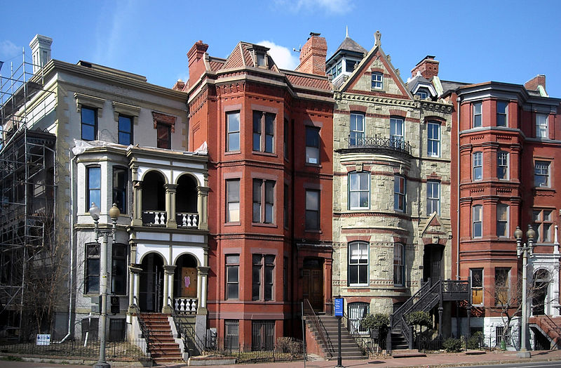
English: Row houses located at 4–7 Logan Circle NW in the Logan Circle neighborhood of Washington, D.C. The homes are contributing properties to the Logan Circle Historic District and the Greater Fourteenth Street Historic District.
|
| Date | |
| Source | Own work |
| Author | APK |
| Permission (Reusing this file) |
I, the copyright holder of this work, hereby publish it under the following license: This file is licensed under the Creative Commons Attribution-Share Alike 3.0 Unported license.
|
| Camera location | | View this and other nearby images on: OpenStreetMap |
|---|
File history
Click on a date/time to view the file as it appeared at that time.
| Date/Time | Thumbnail | Dimensions | User | Comment | |
|---|---|---|---|---|---|
| current | 01:30, 23 July 2011 | | 3,126 × 2,046 (3.68 MB) | MattWade | Correct distortion |
| 18:17, 4 March 2010 |  | 3,227 × 2,115 (5.24 MB) | APK | {{Information |Description={{en|Row houses located at 4–7 Logan Circle, N.W., in the Logan Circle neighborhood of Washington, D.C. The homes are des |
File usage
The following page uses this file:
Global file usage
The following other wikis use this file:
- Usage on ar.wikipedia.org
- Usage on en.wikipedia.org
- Usage on it.wikipedia.org
- Usage on pt.wikipedia.org